
.png)
- Home
- Get Involved
- Committees
- Geospatial Committee
Geospatial CommitteeCommittee Charges
Chair Richard G. Kleinmann (O) (262) 522-4920 (C) (262) 305-4619 kleinmannr@ayresassociates.com |
Geospatial Community Answers Call to Update Benchmarks
https://www.ayresassociates.com/geospatial-community-answers-call-to-update-benchmarks/
- June 15, 2021
Authors:
Dick Kleinmann, PLS, is co-chair of the Wisconsin Spatial Reference System 2022 Task Force (WSRS2022), which was formed to help prepare Wisconsin for the upcoming implementation of the new 2022 datums. Dick is a project manager in Ayres’ aerial mapping group. He plays a leadership role in serving the geospatial and transportation communities at the local, state and national levels. He is the National Society of Professional Surveyors (NSPS) Wisconsin Director and serves as chair of the Wisconsin Society of Land Surveyors (WSLS) Geospatial Committee.
Mick Heberlein, PLS, PS, CFedS, is survey coordinator with WisDOT’s Central Office surveying and mapping section. He’s been with WisDOT since 1987. Mick is a licensed surveyor in Wisconsin and Michigan and is a certified federal surveyor (CFedS). He is a member of the WSRS2022 Technical Focus Group, WSLS DOT Liaison Committee, and the Michigan Tech Surveying Engineering Advisory Board. He is NGS state geodetic coordinator for Wisconsin and past president of the Southwest Chapter of WSLS.
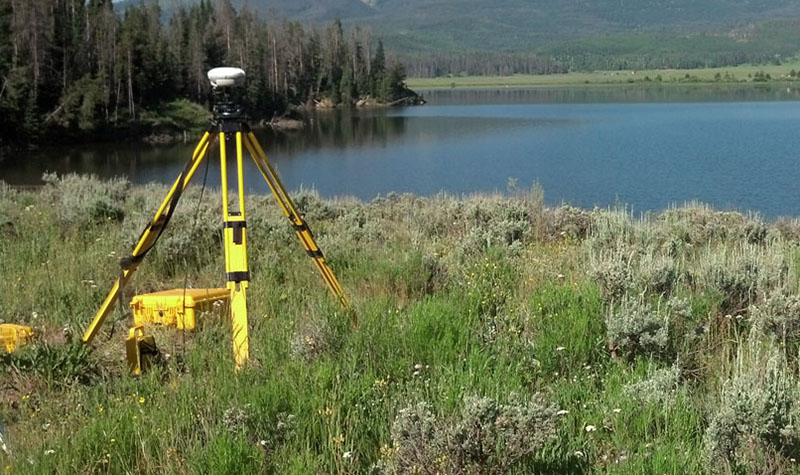
The National Geodetic Survey (NGS) rolled out a program in late 2020 asking surveyors to make GPS observations on existing benchmark monuments nationwide. The intent is to improve the vertical data model and tools that will facilitate transition to new 2022 datums. The effort will also update the status of the national control monument network and ensure these monuments are given up-to-date values in the new datums – in part to account for the movement of survey monuments as the earth’s crust shifts.
In response to this request, the Wisconsin Spatial Reference System 2022 Task Force (WSRS2022) put out a call to action to the Wisconsin geospatial community to get involved. Since then state, county, municipal, and private surveyors have been contributing their time and effort to the cause.
Wisconsin Department of Transportation (WisDOT) staff developed an online mapping tool that complements the NGS effort by pointing surveyors to areas most in need of GPS observations and to provide timely status updates on the effort in Wisconsin.
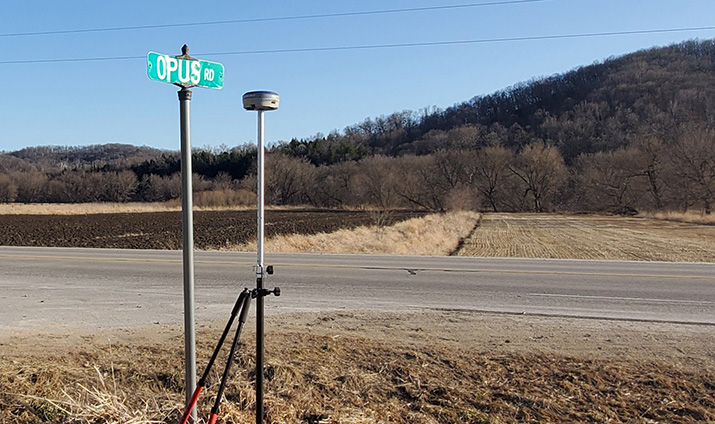
Photo provided by Vernon County surveyor, Laurence Johns.
We want to acknowledge the extraordinary efforts of all the surveyors around Wisconsin – and around the nation – who are contributing hundreds of observations to keep this effort moving forward – in part through NGS’s program called Online Positioning User Service (OPUS). By one measure, Wisconsin ranks No. 2 in the nation for GPS observations completed, as reported in this recent update. WisDOT and similar institutions around the country can’t do this alone, and the contributions of additional observations by non-DOT partners will greatly improve the quality of vertical datum values and transformation tools. WisDOT’s focus expands on the GPS on Benchmark program goals by including observations on horizontal Wisconsin Height Modernization and HARN stations, but their online mapping tool is still very helpful for tracking progress and reporting your observation efforts.
Our message is that even if your organization’s priorities don’t align with NGS or WisDOT priorities, we encourage you to go out and observe on the vertical marks that are important to you and that fit your priorities. For those of you who don’t have GPS equipment but still want to contribute, consider recovering NGS marks and reporting the condition and confirming whether the station is suitable for satellite observations using the NGS Mark Recovery Form.
You will find Mick’s complete progress report in a recent article titled GPS on Bench Marks: Status Update for Wisconsin, published on the State Cartographer’s Office website, home of the Wisconsin Spatial Reference System 2022 Task Force page.
What’s the Deadline for GPS Observation Submittal?
The deadline to submit GPS observations to NGS is December 31, 2021.
Questions?
For more information on this program, contact Dick Kleinmann, co-chair of the Wisconsin Spatial Reference System 2022 Task Force, or Mick Heberlein, NGS state geodetic coordinator for Wisconsin.